
scala 40


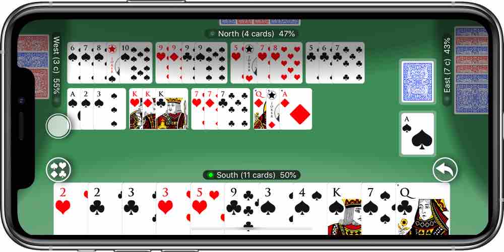
Con l’applicazione Scala 40 di Onmadesoft è possibile giocare a Scala 40 gratis sui dispositivi
Apple e Android Google Play.
Vediamo le caratteristiche dell’App
Giocate gratuitamente contri i vostri iPhone, iPad e Mac o contro altri giocatori online.
Due modalità di gioco offline contro il vostro dispositivo: Partita Singola e Partita a
Punti.
Due modalità di gioco online contro persone reali: Partita Singola e Partita a Punti.
Possibilità di sospendere e riprendere le partite offline (ad esempio per fare una pausa o per
accettare un invito al gioco online si sta giocando offline)
Numero dei giocatori configurabile (da due a quattro)
Classifiche online: una annuale e una mensile per ogni variante di gioco, a queste si aggiungono
classifiche di Natale, Pasqua, Ferragosto, Halloween, Primo Maggio (e altre ancora in
arrivo).
Geo Classifiche: una mappa per visualizzare le classifiche su base geografica (ad esempio per
confrontarti con chi gioca nei tuoi paraggi)
ll gioco online è basato sul regolamento della Federazione Italiana Scala 40
La versione del gioco per iPhone e iPad è finanziata tramite annunci pubblicitari è possibile
disattivarli per sempre acquistando la versione del gioco senza pubblicità.
Per suggerimenti o aiuto contattate l'assistenza, saremo lieti di aiutarvi
se giocare a 'Scala 40' vi diverte, dedicateci un minuto scrivendo una bella recensione:
è sempre
di
grande aiuto e incoraggiamento
La Scala Quaranta è uno dei giochi di carte più diffusi in Italia e ha una storia di oltre 100 anni, si espande infatti orientativamente sul finire della Prima Guerra Mondiale in Ungheria ereditando gran parte delle regole dal Ramino, dal quale discende ma si differenzia. In Italia la Scala 40 arriva intorno agli anni ‘30 dove giochi come il Gin, Wist e il Ramino erano già largamente “giocati”. Nel corso del tempo e con l’avvento della tecnologia, la Scala 40 è approdato anche online diventando uno dei giochi di carte più diffusi in rete nelle varie piattaforme che offrono servizi di gaming. La Scala 40 online mantiene il regolamento del gioco reale con la possibilità di giocare sia in modalità multiplayer che con amici.
La Scala 40 ha una terminologia ben precisa, ci sono infatti termini che rendono il gioco ben
riconoscibile. Vediamoli:
Il mazzo delle carte coperte rimanenti a seguito della distribuzione delle stesse ai giocatori e dal
quale i giocatori possono pescare (leggi anche Scala 40 regole) si
dice
Tallone;
Il mazzo delle carte scartate dai giocatori ad ogni turno si chiama Pozzo o Scarti;
Si dice “gioco” una qualsiasi combinazione o sequenza, laddove per combinazione si intende l’insieme di
3 o 4 carte di uguale valore con semi diversi e per sequenza (o scala), l’insieme formato da un minimo
di 3 ad un massimo di 13 carte con valori in sequenza di uguale seme;
Si dice “Aprire” quando vengono calati sul tavolo da gioco un insieme di giochi del valore di almeno 40
punti;
Si dice “Chiudere” quando vengono calati giochi fino a rimanere senza carte in mano
Per quanto riguarda il valore delle carte, quelle che vanno dal 2 al 10 hanno il valore nominale
(quindi la carta di valore 2, varrà 2 punti e così via);
le figure (fante, re, regina) hanno un
valore
di 10 punti ognuna;
l’Asso ha valore variabile, varrà 1 se usato in sequenze A-2-3 mentre varrà 11
punti se utilizzato in giochi J-Q-K-A oppure in combinazioni A-A-A (quindi se ho 3 carte A-2-3 avrò
fatto 6 punti totali;
se ho assi in accoppiamento a J Q K A il valore singolo dell’asso sarà di 11
per
un totale di 41 punti); il Jolly vale 25 punti se in mano oppure acquisisce il valore della carta che
sostituisce nei giochi sul campo (leggi anche I
Punti nella Scala 40
Come si gioca a Scala 40? Per giocare a Scala 40 occorrono
due mazzi da 54 di
carte francesi, le carte da Scala 40, i giocatori possono variare
da 2 ad un
massimo di 6 e si gioca in “autonomia”, ossia in modo singolo a meno che non si giochi in 4 e quindi
sarà possibile giocare a coppie.
Il mazziere, chi gestisce cioè il gioco, distribuisce 13 carte
coperte
ad ogni giocatore, in senso orario, una alla volta.
Il gioco inizia con la scoperta della prima
carta
del mazzo rimasto (che per alcuni deve essere diversa dal jolly) determinando l’inizio del “pozzo”.
Le
carte in mano ai giocatori possono essere guardate soltanto a seguito della scoperta della prima carta
da parte del mazziere.
While "geofscon" appears to be a common search typo for "GeoFS on," which refers to the popular web-based multiplayer GeoFS flight simulator
, the term can also refer to the community-driven "Best Story" or "Most Helpful" log sorting features found in platforms like Geocaching.
Here is a helpful story that blends the spirit of flight simulation with the discovery found in geocaching: The Flight of the Hidden Horizon
Leo had spent hundreds of hours in the cockpit of a virtual Cessna, banking over digital versions of his own neighborhood in GeoFS. He loved the way the AI-enhanced satellite imagery made the world feel tangible, even from behind a screen. One afternoon, while flying over a remote ridge in the Scottish Highlands, he spotted a peculiar geometric shadow—a perfect circle of stones that didn't appear on any standard map.
Intrigued, Leo did what any modern explorer would do: he cross-referenced the coordinates with a geocaching database. To his surprise, a "Mystery Cache" was located exactly at that spot. The logs for the cache were sorted by "Best Story," and the top entry—a "Most Helpful" account from a veteran hiker—detailed a forgotten shepherd's lookout that could only be reached by following an old, nearly invisible sheep trail.
The story in the log wasn't just a set of directions; it was a guide on how to see the landscape differently. Inspired by both his virtual flight and the hiker’s written journey, Leo eventually made the trip in person. Standing in that stone circle, he realized that the "best" stories are the ones that bridge the gap between our screens and the real world, turning a simple simulation into a lived adventure. How to Create Your Own Stories
If you’re looking to generate your own compelling narratives, expert storytellers and AI tools emphasize several key elements:
The 5 C's: Focus on Character, Context, Conflict, Climax, and Closure to give your story a solid backbone.
Emotional Connection: The most helpful stories resonate because they prioritize human emotion over simple facts.
AI Assistance: Tools like Jasper AI or Squibler can help draft initial ideas, while QuillBot is often used for general writing assistance.
Brainstorming: Start with a simple prompt—like a romantic text chain or a moment you wish you’d handled differently—to spark a unique hook.
"GeoFSCon" likely refers to a community-organized event or gathering for users of GeoFS (a web-based flight simulator). To draft an effective text for this event, it is best to focus on the key components of a convention or virtual fly-in: schedule, featured routes, and platform rules. Draft Text: GeoFSCon Event Announcement
Subject: Join Us for GeoFSCon 2026 – The Ultimate Virtual Fly-In! Hello Aviators,
We are thrilled to announce the return of GeoFSCon, our annual community gathering! Whether you are a seasoned captain or a student pilot, join us for a day of formation flying, group challenges, and technical showcases. Event Highlights:
The Main Fly-In: A group flight departing from [Departure Airport] and ending at [Destination Airport].
ATC Showcase: Live Air Traffic Control provided by our community team for a realistic experience.
Aircraft Mod Spotlights: A look at the latest community-developed aircraft skins and flight models.
Q&A Session: A live chat with some of the most active contributors in the GeoFS Forum. Event Details: Date: Saturday, April 25, 2026 Time: [Insert Start Time] UTC Server: [Insert Server Name/Number]
Communication: Join our [Discord Link] for live voice and coordination.
Registration:To help us manage server load, please register your flight plan on our official community page or via the GeoFS Community Groups. Blue skies and happy flying! Best Practices for Your Draft:
Be Specific on Servers: Since GeoFS can experience lag during large events, specify which server or "room" participants should join.
Include a Discord Link: Most GeoFS events rely on Discord for real-time ATC and coordination.
Mention Mods: If the event requires specific scripts or community mods (like the "GeoFS Enhancement" mod), include links to the GitHub Repository or relevant install guides.
Tip: The exact date changes yearly. Check the GeoFS subreddit (r/GeoFS) or the Official GeoFS Discord for announcements about the next Con. geofscon best
GEOFSCON Best stands at the forefront of geospatial technology, offering a powerful solution for data integration, analysis, and visualization. Its comprehensive features, coupled with user-friendly accessibility, make it an indispensable tool for professionals across various sectors. As the demand for geospatial data analysis continues to grow, solutions like GEOFSCON Best will play a pivotal role in shaping the future of informed decision-making and strategic planning.
is a free, web-based flight simulator that utilizes global satellite imagery to provide an accessible and immersive aviation experience. The term
is often used by the community to refer to organized multiplayer events, airshows, and virtual conferences that celebrate the platform's "best" features and user contributions. The Essence of GeoFSCon While not a single physical convention like FlightSimExpo
, GeoFSCon represents the peak of community engagement. These events typically feature: Virtual Airshows
: Community members showcase custom aircraft and precision formation flying. Landing Competitions
: Challenging pilots to perform the perfect touchdown at iconic global airports. Developer Showcases : Highlighted aircraft such as the community-contributed 787-8 or F-14B Tomcat Collaborative Sessions : Group flights often coordinated through GeoFS Events Discord The "Best" of GeoFS: Key Features
To understand why GeoFSCon thrives, one must look at the simulator's core strengths: Testimonials - GeoFS
GeoFSCon: Why It’s the Best Experience for Flight Sim Enthusiasts
If you’ve spent any amount of time soaring through the virtual skies of GeoFS (the web-based flight simulator), you know that the community is just as important as the flying itself. While solo flights are great for practicing landings, nothing beats the organized chaos and camaraderie of a massive fly-in.
That brings us to the gold standard of community events: GeoFSCon. If you’re looking for the absolute "best" the sim has to offer, here is why GeoFSCon consistently takes the top spot. What is GeoFSCon?
GeoFSCon is an annual (or semi-annual) community-organized convention held within the GeoFS simulator. Think of it as a digital "Oshkosh" or "EAA AirVenture." It’s a multi-day event where hundreds of pilots gather at a specific airport to participate in airshows, formation flights, and technical workshops. Why it’s Considered the "Best" Event in GeoFS 1. Unmatched Scale
Most GeoFS events are small, localized fly-ins with maybe 10 or 20 players. GeoFSCon is on a different level. It attracts the most skilled pilots, the most active virtual airlines (VAs), and the most dedicated controllers. When people search for "GeoFSCon best," they are usually looking for those high-population instances where the sky is literally filled with blinking navigation lights. 2. Professional Air Traffic Control (ATC)
One of the highlights of a "best-in-class" GeoFSCon is the quality of the ATC. During the convention, professional-grade controllers manage the airspace, providing a level of realism you rarely find on public servers. Navigating a busy approach path into a designated "Con" airport is a thrill that tests even veteran pilots. 3. The Airshows and Stunt Teams
GeoFSCon is the stage where the sim's elite flight teams show off. From perfectly synchronized maneuvers by the virtual Blue Angels to solo aerobatic displays in the Extra 330, the visual spectacle is easily the best part of the weekend. It’s not just about flying; it’s about performance art at 30,000 feet. 4. Innovation and Custom Models
Often, developers and talented community members use GeoFSCon to debut new aircraft models or high-definition livery packs. It acts as a "tech demo" for what the community can achieve within the constraints of a browser-based simulator. How to Get the Best Experience at GeoFSCon
To make sure your experience is "the best," follow these quick tips:
Check the Discord: Most GeoFSCon planning happens on community Discord servers. This is where you’ll find the schedule, the "official" airport location, and the specific server instructions.
Lower Your Settings: With hundreds of planes in one area, your browser might struggle. Set your "Visibility" and "Traffic" settings to a manageable level to avoid crashing (your computer, not your plane!).
Respect the Rules: The best GeoFSCons are the ones where people follow ATC instructions. Don't be the person spawning a 747 on the active runway during an airshow! The Verdict
GeoFSCon represents the peak of what a browser-based community can accomplish. It turns a simple flight sim into a living, breathing aviation world. Whether you’re a casual flyer or a hardcore captain, attending a GeoFSCon is the best way to see the simulator's true potential.
While "GeoFSCon" (likely referring to a GeoFS Convention) is a community-driven concept within the GeoFS (web-based flight simulator) enthusiast circle, there is currently no evidence of an official, large-scale annual convention under that specific name. Instead, the "best" of the GeoFS community experience—often informally termed GeoFSCon by players—revolves around organized multi-player fly-ins and virtual airline events. Deep Review of the GeoFS Experience
GeoFS provides a unique, accessible flight simulation platform. Below is a review of what enthusiasts consider the "best" parts of the platform's ecosystem:
Accessibility & Engine: Its greatest strength is being entirely browser-based. It utilizes CesiumJS to render global satellite imagery, allowing you to fly over any real-world address without heavy installations. While "geofscon" appears to be a common search
Physics & Realism: Despite running in a browser, it features a realistic physics engine that simulates lift, drag, and stalls on all aircraft surfaces.
Multiplayer Community: The "best" way to experience a "convention" vibe is through the built-in multiplayer mode. This allows hundreds of players to see each other in real-time, forming spontaneous airshows or formation flights.
Community Roleplay: The GeoFS Wiki and Discord-based "Virtual Airlines" host scheduled events that act as virtual conventions. These involve strict ATC (Air Traffic Control) procedures and "Realistic Roleplay" rules, such as announcing gunfire during combat simulations. "GeoFSCon Best" Community Highlights
If you are looking for the top-rated community-organized events:
Fly-ins: Often hosted at major hubs like KSFO (San Francisco) or EGLL (London Heathrow).
Add-ons: The community frequently creates custom scripts and aircraft skins that enhance the base experience, which are often debuted during these large-scale gatherings. Technical Requirements:
Internet: A stable connection is mandatory for real-time terrain streaming.
Hardware: While browser-based, a recommended 32GB of RAM and 8GB of VRAM ensures the smoothest performance for large multiplayer gatherings. GeoFS - Free Online Flight Simulator
The GEOFSCON Best initiative is a notable effort aimed at enhancing geospatial data standards and interoperability. While there isn't a widely recognized entity or document specifically known as "GEOFSCON Best," for the purpose of this essay, let's assume it refers to best practices or standards in geospatial data management and interoperability, perhaps related to or inspired by the activities and goals of organizations like the Federal Geographic Data Committee (FGDC) and the International Organization for Standardization (ISO).
The Importance of Geospatial Data Standards: A GEOFSCON Best Approach
In an increasingly data-driven world, geospatial information plays a critical role in decision-making processes across various sectors, including environmental management, urban planning, emergency response, and more. The efficient use of geospatial data, however, heavily depends on the establishment and adherence to standards that ensure data interoperability, accuracy, and accessibility. This essay explores the significance of adopting best practices in geospatial data management and interoperability, using a hypothetical GEOFSCON Best framework as a guiding model.
The Challenge of Geospatial Data Management
Geospatial data, which includes information about the Earth's physical features, human populations, and the ways in which they are organized and interact, is inherently complex. It comes in various formats (e.g., satellite imagery, GPS data, geographic information systems (GIS) databases) and scales, from local to global. Without standardized methods for data collection, storage, sharing, and analysis, the integration and application of geospatial data across different platforms and organizations become significantly challenging.
Principles of GEOFSCON Best
Assuming the GEOFSCON Best initiative aims to promote excellence in geospatial data management, several key principles could underpin its framework:
Implementing GEOFSCON Best Practices
The implementation of GEOFSCON Best practices would require a multi-faceted approach:
Benefits of GEOFSCON Best
The adoption of GEOFSCON Best practices would have numerous benefits:
Conclusion
The hypothetical GEOFSCON Best initiative underscores the importance of establishing and adhering to best practices in geospatial data management and interoperability. By embracing such standards, organizations and governments can ensure that geospatial data is accessible, accurate, and usable across different platforms and applications. This not only enhances decision-making and efficiency but also contributes to the development of more informed, resilient, and sustainable communities. As we move forward in an increasingly data-driven world, the principles of GEOFSCON Best can serve as a valuable guide for maximizing the utility and value of geospatial information.
"GeoFSCon" typically refers to the community-driven convention or gathering for
(a web-based flight simulator). These events are generally organized by the community to showcase new developments, discuss flight simulation mechanics, and host virtual flight displays. Based on current community trends and information for 2026: Best Content & Highlights Virtual Airshows When & Where does it happen
: The "best" parts of GeoFSCon are often the coordinated aerial displays. Teams use highly detailed GeoFS aircraft models
to perform synchronized maneuvers that mimic real-world aerobatic teams. Technical Showcases
: Developers often debut high-quality community-made add-ons, including custom terrain, high-definition cockpits, and improved flight physics plugins. Community Networking
: It serves as the primary hub for virtual airlines and flight schools within the GeoFS ecosystem to recruit new pilots and announce partnerships. Where to Find Detailed Text & Updates
For the most detailed and current "best of" information regarding the latest GeoFSCon, you should check the following community hubs: Official GeoFS Forum
: The primary source for official announcements and retrospective threads detailing event winners and highlights. GeoFS Discord Servers
: Most real-time coordination and detailed "after-action" reports (AARs) are posted in community-run Discord channels.
: Search for "GeoFSCon 2025" or "GeoFSCon 2026" to find recorded streams of the virtual airshows and technical presentations. for the next convention or lists of winners from the most recent virtual airshow?
Generative Engine Optimization (GEO) is an emerging digital marketing strategy designed to increase a website's visibility within AI-generated responses from platforms like ChatGPT, Claude, and Google’s AI Overviews. Unlike traditional SEO, which focuses on ranking in a list of links, GEO focuses on making content the primary source that an AI "cites" or summarizes when answering a user's prompt. Core Principles for Success
To rank best in generative engines, content must prioritize conversational clarity and factual precision over simple keyword matching.
Factual Density: High-performing GEO content includes specific statistics, data points, and named entities. Academic research indicates that adding relevant statistics can significantly boost an AI's likelihood of citing a source.
The "Answer-First" Structure: Lead each section with a direct, 40–80 word summary that answers the exact user query before diving into details.
Cite Authoritative Sources: Building credibility through external links and expert quotes makes content appear more reliable to AI models, which often look for "trust signals".
Information Gain: AI engines favor content that provides unique value or new data that isn't already widely available in their training sets. Best Practices for Content Structuring
Structuring your write-up helps AI models parse and extract your information more efficiently.
A Guide to Generative Engine Optimization (GEO) Best Practices
community to refer to organized multiplayer fly-in events or conventions.
Here are three post templates you can use to announce or recap a "GeoFSCon" event, depending on your needs: Option 1: The Event Announcement (Hype) Get people to join your upcoming fly-in. GeoFSCon 2026: Clear for Takeoff!
Get your flight plans ready! We are hosting the ultimate community fly-in this weekend. Whether you're piloting an A380 or a Cessna, everyone is welcome to join the formation. Departure: [Insert Airport, e.g., KSFO] [Insert Destination] [Insert Date & Time] [Insert Server Name/Discord Link] Let’s fill the skies! Tag your co-pilot below. 👇 #GeoFS #GeoFSCon #FlightSim #AviationDaily Option 2: The "Best Of" Recap Show off screenshots or highlights from a completed event. GeoFSCon was a VIBE!
Massive shoutout to everyone who showed up for our latest fly-in. From the smooth landings at [Airport Name] to the chaotic formation flying over the mountains, this was easily our best event yet.
Check out some of the best shots from the community! Which aircraft was your favorite? [Insert/Attach Screenshots] #GeoFS #GeoFSCon #VirtualAviation #FlightSimulator Option 3: The Short & Punchy (Twitter/X Style) Quick engagement. The GeoFSCon community is unmatched. ✈️🌍
Best flight of the year so far? Definitely today’s group leg to [Destination]. Thanks to everyone for keeping it (mostly) professional on the ATC! Where should we fly next? ✈️👇 #GeoFS #GeoFSCon Pro-Tip for GeoFS Posts: Use the Map: If you are the organizer, use the GeoFS - Free Online Flight Simulator map to share a screenshot of the intended flight path. Coordinate: If you use a specific AI ATC script
or Discord server for voice comms, make sure to link it so users can interact during the flight. narrow these down for a specific platform like Discord or Instagram? GeoFS - Free Online Flight Simulator
GeoFS Con matters because it lowers the barrier to entry. You don’t need a $2,000 PC or a pilot’s license to feel the tension of a low-visibility approach into Innsbruck. You just need Chrome, an internet connection, and curiosity.
The event has become a proving ground for young simmers who later graduate to MSFS or X-Plane—and occasionally, for real student pilots practicing dead reckoning in a low-stakes environment.
Seppur il gioco di carte Scala 40 abbia un regolamento ufficiale,
esistono moltissime varianti utilizzate soprattutto nei vari Tornei di
Scala 40 che vengono organizzati in giro per il mondo.
Le varianti dei giochi di carte sono
diffusissime, la cosa importante da tenere a mente è che prima di adottarle tutti i partecipanti
al tavolo dovranno essere d’accordo. Alcune varianti in voga sono le seguenti:
Chiaramente è da ricordare che la Scala 40 è a tutti gli effetti un gioco di strategia, ogni variante quindi presupporrà una diversa attitudine nell’affrontare le Strategie della Scala 40